- Las Positas College
- Drone Technology
- Drones & Archaeology
Drone Technology
Drones & Archaeology

Archaeology has a long history of using aerial photography in their work. In the past large balloons and small planes offered high-altitude wide viewsheds to better visualize the landscape. At the ground level, ladders, small balloons, and even kites have been useful to gain a top down view of an excavation site.
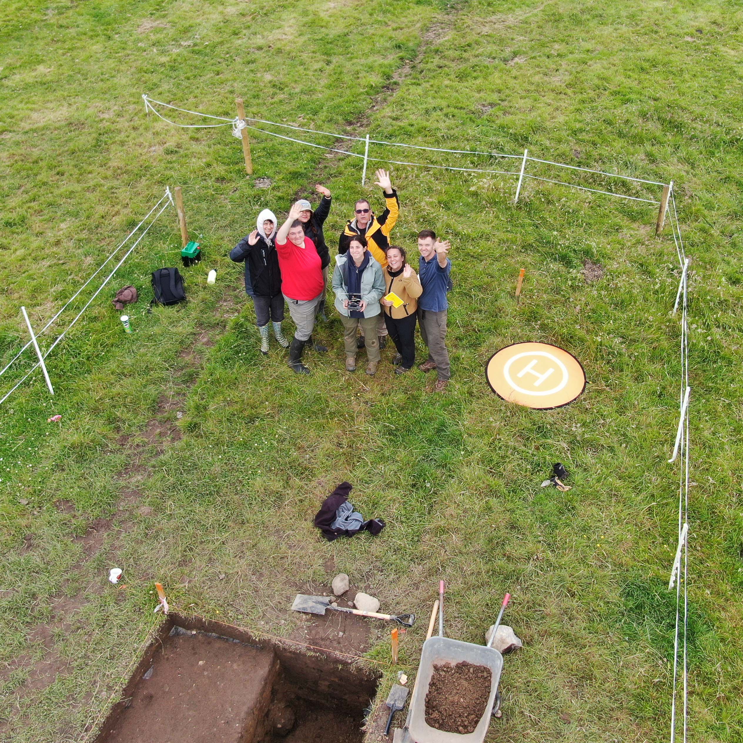
(Restoration Work, Ballintober Castle, Ireland 2022 - Castles In Communities)
With the emergence of easy to operate drones capable of carrying high resolution cameras and other sensors, they are becoming more common if not an expected piece of equipment to have in the “tool box.” Today’s drones are being used to efficiently cover large amounts of territory quickly for ground surveys, or in contrast, they can hover over small excavation area to capture oblique or vertical images. They are versatile and, like other industries, their implementation, application, and understanding of how they might be used remains to be fully understood. What is clear is that it is an exciting time to be an archaeologist.

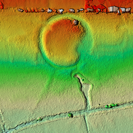
(Ring Fort as Surface Relief, Ireland 2023 - Castles In Communities)
Uses in Archaeology
- Aerial Survey and Mapping
- Localized Micro-Topographical Relief
- Localized Micro Remote Sensing (LIDAR, Multi-Spectral, Thermal)
- 3D Point Cloud, Volumetric Calculation, Cross-Sectional Analysis
- Timelapse and Excavation Progress
- Report Images, Marketing, and Social Media
Drones, Archaeology & Las Positas
Las Positas is uniquely positioned to contribute to training and research on drones in archaeology. We have been using drones in collaboration with other Bay Area colleges since 2020. Our students and instructors have done demonstrations, surveys, and trainings for local field programs and during summer archaeological projects abroad.
If you are interested in collaborating on any archaeological project, please contact us, we would love to hear from you!
Project Examples
Las Positas partners with the Castle In Communities - Anthropological Field School, where we have been using drones in parallel with other common survey equipment and routine field practices to provide georeferenced, high resolution, images, 3D models, and digital surface models. Below is one of our excavation units at the entrance of Ballintober Castle - C3. Our goal is to expose the entrance in preparation for a modern public accessible entry point, we are very excited with our progress.
Foothill College, Hidden Villa Archaeological Field School
Below is an explanation of how drone aquired LIDAR data can be used to create topographical renderings. Las Positas College was invited to participate in the Summer Archaeological Field School at Foothill College.

Daniel Cearley
Office 21156 - Building 2100 (First Floor)
(925) 424-1203
dcearley@laspositascollege.edu
Current Weather Conditions
Las Positas Weather Station

